Cottonwood Pass Summary
Cottonwood Pass is re-paved on the east side and fully paved on the west side. No more dirt, dust, and mud. This is one of my favorite passes and is a great shortcut and alternative to Monarch Pass going between Buena Vista and Crested Butte in the summer. While paved, it still closes for the winter. Using the words incredible, gem, spectacular, etc. don’t even start to describe the pass. The pass tops out over 12,000 feet, has the third highest paved road in the state, has an incredible tree lined climb on the east side with a 10% grades section. It has switchbacks, scenery, and very little traffic.
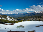
As you can tell from the pictures, this pass has lots of snow into June. One trip, a few years back, I didn't follow my own advice about what to wear on high mountain roads. I lacked full finger gloves. I was totally warm and dry in the rain/wind/snow except for my hands and my wet frozen hands made the descent miserable. When I suggest bringing cold weather gear, particularly on these high passes, not only should you heed the warning, but so should I. I was trying to minimize weight and was very foolish not to bring gloves.
Personally, I love riding this pass from Crested Butte or Gunnison to Buena Vista. . From Almont you’ll ride roughly 37 miles to get to the summit. You’ll gain about 1000 feet in 20 miles of tree lined beauty along side the Tayor River. The trees are quite heavy here so it will be shaded. The final climb to the summit on both sides is quite steep, but a number of the west side dirt switchbacks have been eliminated with wider and more gradual paved turns. A new restroom has been added just below the summit on the west side.
At the Taylor Park Reservoir, you are 13.5 miles from the top (and this is where the profile above starts). After a few miles of riding some small rollers on the east side of the lake, you will make a right turn toward the pass and will start your trek up the pass. As you climb, the grades will get steeper and you will go through a series of switchbacks, 7 of them, (down from 14 with the paved roads) plus many wider curves. You’ll find most of the climbs in the 5% to 7% range with fewer and fewer flat spots as you get closer to the top. The views on the west side are spectacular and you’ll want to make a number of stops to just take in what’s around you.
The east side of the pass in breathtaking in a number or ways. First, it’s steep. If you like the challenge of a good leg burning climb, you’ve found it. Roughly halfway up, you’ll come across a wall. The grade is 10% and it’s about half to three quarters of a mile long. This is a great point for speed on the downhill, but on the climb, it will take your breath away. The east side also has tight switchbacks, eight, to contend with. Overall, the east side is steeper and has a lot more climbing than the west, hence the reason for the difficult rating.
Given that the pass is over 12,000, it’s likely you will find snow at the summit year round. But more than that, this is a pass where the weather will change rapidly and any attempt to ride the pass should be done with due care. Have a lot of water with you and have foul weather gear. The ride is rather remote and you won’t see too many other people if you need help.
Alternate Routes
From Buena Vista, just about any direction you go, you’ll end up with a great ride.
From Buena Vista to the north, you can head to Leadville and take Fremont Pass to Copper Mt or Tennessee Pass to Minturn and Vail. You can also turn west at Twin Lakes and take Independence Pass to Aspen and Glenwood Springs.
East of Buena Vista, you can head to Colorado Springs vial Trout Creek Pass.
South of Buena Vista you can head to Salida and on to Poncha Pass or head to Gunnison via Monarch Pass.
All of these can be one day trips and all have great scenery and good climbs and descents.
Traffic will be heaviest east and south, but early morning weekday rides tend to mitigate that.
Bottom line, Buena Vista is a great place to base yourself for any number if great rides, not to mention it’s a hub for river rafting for a nice break.

 Taylor Park
 New road at summit. West side (June 2020) of Cottonwood Pass
 Summit of Cottonwood Pass (No restrooms)
 Looking back on Taylor Park (June 2020)
 Looking east, just below the summit (June 2020).
 View from summit looking east
 View from summit looking west
 Outside Buena Vista, looking toward Cottonwood Pass